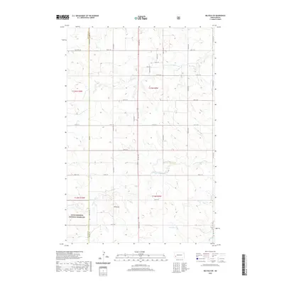
2020 Map of Belfield SW
USGS Topo · Published 2020About this map
Little Missouri National Grassland encompasses the western reaches of this North Dakota landscape, where the high plains of Stark and Billings counties meet. The terrain is defined by the drainage of the S Br Heart River and its various tributaries, including Norwegian Cr and Bull Cr. A prominent landmark, Rocky Hill, rises above the surrounding sections, marking the transition from open grazing land to the more broken geography typical of the region. The map reveals a systematic grid of section lines and rural routes, such as Sully Creek Rd and 38th St SW, which facilitate access across these expansive parcels. This 2020 survey documents the intersection of public land management and private agricultural sections, anchored by local water sources like Black Spring.
Find a feature on this map
30 named features on this map. Tap any name to fly to it.
Don’t see what you’re looking for? This feature index may not catch every label — zoom into the map to look around manually.
Map Details
Editions of this 2020 Belfield SW Map
This is the sole edition of this map. No revisions or reprints were ever made.
Other maps of this area

1953 · Dickinson
USGS Topo · 1:250,000

1957 · Dickinson
USGS Topo · 1:250,000

1961 · Daglum
USGS Topo · 1:62,500

1961 · Rocky Ridge
USGS Topo · 1:62,500

1962 · Fryburg NE
USGS Topo · 1:24,000

1962 · Belfield NE
USGS Topo · 1:24,000

1962 · Belfield SW
USGS Topo · 1:24,000

1962 · Fryburg
USGS Topo · 1:24,000

1962 · Belfield
USGS Topo · 1:24,000

1962 · Belfield SE
USGS Topo · 1:24,000