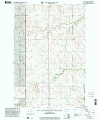
1997 Map of Belfield SW
USGS Topo · Published 2001About this map
The Little Missouri National Grassland dominates the western portion of this landscape, marking the edge of a region defined by its complex drainage systems and extractive history. In the late 1990s, the terrain south of Belfield is characterized by the headwaters of the Heart River, which is fed by the South Branch Heart River and Norwegian Creek. The geography here is punctuated by numerous Scoria Pits, Mine, and other Mines, signaling a landscape deeply engaged with the local geology. Sparse rural infrastructure is represented by landmark educational sites such as Belfield Sch No 1 and Dorval Sch, which provided essential services to the scattered ranching and mining communities. From the heights of Rocky Hill down to the seasonal flow of Bull Cr and Black Spring, this survey captures a remote section of the North Dakota badlands during a period of modern agricultural and industrial transition.
Find a feature on this map
16 named features on this map. Tap any name to fly to it.
Don’t see what you’re looking for? This feature index may not catch every label — zoom into the map to look around manually.
Map Details
Editions of this 1997 Belfield SW Map
This is the sole edition of this map. No revisions or reprints were ever made.
Other maps of this area

1953 · Dickinson
USGS Topo · 1:250,000

1957 · Dickinson
USGS Topo · 1:250,000

1961 · Daglum
USGS Topo · 1:62,500

1961 · Rocky Ridge
USGS Topo · 1:62,500

1962 · Fryburg NE
USGS Topo · 1:24,000

1962 · Belfield NE
USGS Topo · 1:24,000

1962 · Belfield SW
USGS Topo · 1:24,000

1962 · Fryburg
USGS Topo · 1:24,000

1962 · Belfield
USGS Topo · 1:24,000

1962 · Belfield SE
USGS Topo · 1:24,000