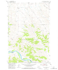
1954 Map of Bell Ridge West
USGS Topo · Published 1978About this map
Missouri River bottomlands and the rugged breaks of central Montana define this 1954 topographic record. The landscape is marked by a series of named riverside terraces, including Kendall Bottoms, Knox Bottoms, Le Clair Bottoms, and Gardipee Bottoms, illustrating the historical importance of these flat, arable pockets along the water. To the north, the terrain rises into the distinctive ridges of the Charles M. Russell National Wildlife Range, where Bell Ridge and Siparyann Ridge overlook deep drainage systems like Duval Gulch and Bogg Gulch. Evidence of mid-century land use is found at the Kendall Cow Camp and a remote Landing Strip near the river, reflecting the ranching and resource management practices in Phillips and Fergus Counties during the post-war era.
Find a feature on this map
25 named features on this map. Tap any name to fly to it.
Don’t see what you’re looking for? This feature index may not catch every label — zoom into the map to look around manually.
Map Details
Editions of this 1954 Bell Ridge West Map
3 editions found
Other maps of this area

1943 · Landusky
USGS Topo · 1:125,000

1954 · Bell Ridge East
USGS Topo · 1:24,000

1954 · Hessler Ridge
USGS Topo · 1:24,000

1954 · Carter Coulee
USGS Topo · 1:24,000

1954 · Bell Ridge West
USGS Topo · 1:24,000

1954 · Grand Island
USGS Topo · 1:24,000

1954 · Lewistown
USGS Topo · 1:250,000

1959 · Lewistown
USGS Topo · 1:250,000

1971 · Hays SE
USGS Topo · 1:24,000
1971 · D Y Junction
USGS Topo · 1:24,000