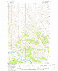
1954 Map of Bell Ridge West
USGS Topo · Published 1982About this map
The Missouri River carves a deep path through this mid-century landscape on the border of Phillips and Fergus counties. Extensive alluvial flats, including Kendall Bottoms, Knox Bottoms, and Le Clair Bottoms, line the riverbanks below the steep elevation of Bell Ridge. This area is largely defined by the Charles M. Russell National Wildlife Range, which preserves the broken coulee country and riparian breaks typical of the Missouri River Basin development program.
Find a feature on this map
22 named features on this map. Tap any name to fly to it.
Don’t see what you’re looking for? This feature index may not catch every label — zoom into the map to look around manually.
Map Details
Editions of this 1954 Bell Ridge West Map
3 editions found
Other maps of this area

1943 · Landusky
USGS Topo · 1:125,000

1954 · Bell Ridge East
USGS Topo · 1:24,000

1954 · Hessler Ridge
USGS Topo · 1:24,000

1954 · Carter Coulee
USGS Topo · 1:24,000

1954 · Bell Ridge West
USGS Topo · 1:24,000

1954 · Grand Island
USGS Topo · 1:24,000

1954 · Lewistown
USGS Topo · 1:250,000

1959 · Lewistown
USGS Topo · 1:250,000

1971 · Hays SE
USGS Topo · 1:24,000
1971 · D Y Junction
USGS Topo · 1:24,000