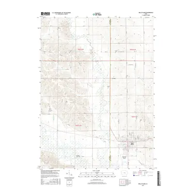
2015 Map of Belle Plaine
USGS Topo · Published 2015About this map
Belle Plaine anchors the southeastern corner of this Iowa landscape, where the grid of city streets gives way to the broad alluvial plains of the Iowa River. The terrain is defined by the steady southward flow of Salt Creek, which carves a wide, marshy path through the center of the quadrangle before its confluence with the river. To the north, the small settlement of Irving sits along the Benton Co Tama Co line, surrounded by a dense network of family-named cemeteries that speak to the deep agricultural roots of the region.
Find a feature on this map
61 named features on this map. Tap any name to fly to it.
Don’t see what you’re looking for? This feature index may not catch every label — zoom into the map to look around manually.
Map Details
Editions of this 2015 Belle Plaine Map
This is the sole edition of this map. No revisions or reprints were ever made.
Other maps of this area

1954 · Waterloo
USGS Topo · 1:250,000

1954 · Des Moines
USGS Topo · 1:250,000

1955 · Waterloo
USGS Topo · 1:250,000

1956 · Des Moines
USGS Topo · 1:250,000

1957 · Des Moines
USGS Topo · 1:250,000

1965 · Ladora
USGS Topo · 1:24,000

1965 · Keystone South
USGS Topo · 1:24,000

1968 · Belle Plaine SW
USGS Topo · 1:24,000

1968 · Belle Plaine
USGS Topo · 1:24,000

1968 · Chelsea
USGS Topo · 1:24,000