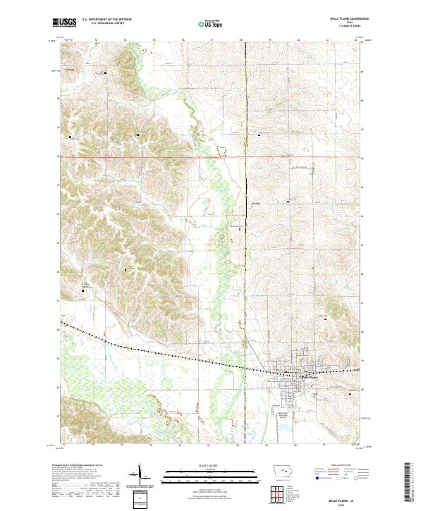
2022 Map of Belle Plaine
USGS Topo · Published 2022About this map
The Iowa River corridor dominates the southern half of this landscape, creating a broad floodplain where Otter Cr, Plague Mine Cr, and Salt Creek converge. The town of Belle Plaine serves as the regional hub, situated north of the river and the Belle Plaine Municipal Airport. This modern survey reveals a dense network of family-named burial grounds that speak to the area’s deep agricultural roots, including the Flathers Hancox-Walton Cem, Arbuthnot Cem, and Dvorak Cem.
Find a feature on this map
58 named features on this map. Tap any name to fly to it.
Don’t see what you’re looking for? This feature index may not catch every label — zoom into the map to look around manually.
Map Details
Editions of this 2022 Belle Plaine Map
This is the sole edition of this map. No revisions or reprints were ever made.
Other maps of this area

1954 · Waterloo
USGS Topo · 1:250,000

1954 · Des Moines
USGS Topo · 1:250,000

1955 · Waterloo
USGS Topo · 1:250,000

1956 · Des Moines
USGS Topo · 1:250,000

1957 · Des Moines
USGS Topo · 1:250,000

1965 · Ladora
USGS Topo · 1:24,000

1965 · Keystone South
USGS Topo · 1:24,000

1968 · Belle Plaine SW
USGS Topo · 1:24,000

1968 · Belle Plaine
USGS Topo · 1:24,000

1968 · Chelsea
USGS Topo · 1:24,000