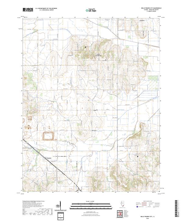
2024 Map of Belle Prairie City
USGS Topo · Published 2024About this map
Belle Prairie City and the small hamlets of Piopolis and Delafield anchor this corner of Hamilton County, where a grid of rural county roads overlies a landscape defined by its many winding watercourses. The northern reaches are drained by Shelton Creek and the Kennedy-Voris Main Drain, while Big Creek and Middle Creek meander through the southern sections. This modern survey reveals a highly organized agricultural layout, where family names and local history are preserved in sites like Rawls Cem, Crouch Cem, and Cherry Grove Cem. The presence of established drainage systems like Dry Island Drain and Black Branch suggests a history of careful water management to sustain the surrounding farmsteads. These patterns of settlement and land use reflect the long-standing importance of this fertile Illinois prairie region.
Find a feature on this map
43 named features on this map. Tap any name to fly to it.
Don’t see what you’re looking for? This feature index may not catch every label — zoom into the map to look around manually.
Map Details
Editions of this 2024 Belle Prairie City Map
This is the sole edition of this map. No revisions or reprints were ever made.
Other maps of this area

1941 · Enfield
USGS Topo · 1:62,500

1942 · McLeansboro
USGS Topo · 1:62,500

1944 · Enfield
USGS Topo · 1:62,500

1945 · McLeansboro
USGS Topo · 1:62,500

1947 · Wayne City
USGS Topo · 1:62,500

1948 · Fairfield
USGS Topo · 1:62,500

1958 · Belleville
USGS Topo · 1:250,000

1962 · Belleville
USGS Topo · 1:250,000
1971 · Boyleston
USGS Topo · 1:24,000
1973 · Wayne City
USGS Topo · 1:24,000