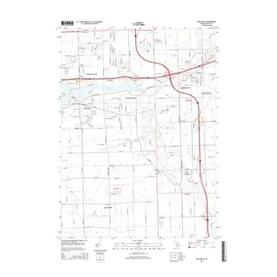
2014 Map of Belleville
USGS Topo · Published 2014About this map
Belleville Lake and the winding course of the Huron River dominate this modern landscape in Wayne County, Michigan. The map illustrates a high degree of infrastructure development, where the massive footprint of the Detroit Metropolitan Wayne County Airport in Romulus meets a dense network of modern transit. Despite this modernization, older settlement patterns remain visible in the placement of Hillside Cem and Otisville Cem. The southern portion of the map near Martinsville and New Boston retains a more rural character, defined by an intricate system of agricultural and roadside drainage like Randell Drain and Weightman Drain. This document provides a clear look at how 21st-century logistics and aviation infrastructure have integrated with established communities like Belleville and the historic transit point at French Landing along the Norfolk Southern rail line.
Find a feature on this map
202 named features on this map. Tap any name to fly to it.
Don’t see what you’re looking for? This feature index may not catch every label — zoom into the map to look around manually.
Map Details
Editions of this 2014 Belleville Map
This is the sole edition of this map. No revisions or reprints were ever made.
Other maps of this area

1902 · South Lyon
USGS Topo · 1:62,500

1902 · Ypsilanti
USGS Topo · 1:62,500

1904 · Ann Arbor
USGS Topo · 1:125,000

1905 · Wayne
USGS Topo · 1:62,500

1906 · Ypsilanti
USGS Topo · 1:62,500

1906 · South Lyon
USGS Topo · 1:62,500

1906 · Romulus
USGS Topo · 1:62,500

1908 · Ann Arbor
USGS Topo · 1:125,000

1912 · Wayne
USGS Topo · 1:62,500

1928 · Romulus
USGS Topo · 1:62,500
Featured Places
- Van Buren Charter Township, MI
- Romulus, MI
- Huron Charter Township, MI
- Sumpter Township, MI
- Belleville, MI