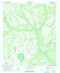
1974 Map of Bellevue
USGS Topo · Published 1991About this map
Buckhead Creek and its many tributaries, including Rosemary Creek and Rocky Creek, dominate this rural landscape straddling the Burke and Jenkins County line. The area is defined by a dense network of country churches that likely served as the centers of social life for the surrounding agricultural community, such as McCullough Grove Ch, Salters Grove Ch, and Carswell Grove Ch. Settlement is sparse, with the small community of Bellevue and the area near McCullough Millpond being the primary focal points.
Find a feature on this map
29 named features on this map. Tap any name to fly to it.
Don’t see what you’re looking for? This feature index may not catch every label — zoom into the map to look around manually.
Map Details
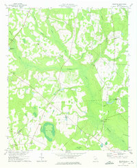
Editions of this 1974 Bellevue Map
2 editions found
Other maps of this area

1919 · Gough
USGS Topo · 1:62,500

1920 · Millen
USGS Topo · 1:62,500

1920 · Greens Cut
USGS Topo · 1:62,500

1943 · Greens Cut
USGS Topo · 1:62,500

1943 · Millen
USGS Topo · 1:62,500

1943 · Augusta East
USGS Topo · 1:125,000

1943 · Millen
USGS Topo · 1:125,000

1947 · Savannah
USGS Topo · 1:250,000

1948 · Savannah
USGS Topo · 1:250,000

1948 · Gough
USGS Topo · 1:62,500