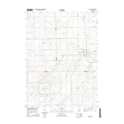
2014 Map of Bellevue
USGS Topo · Published 2014About this map
Bellevue serves as the central hub of this Michigan landscape, situated at the meeting point of several historic townships and county lines. The town is positioned along the winding course of Battle Cr, surrounded by a network of drainage systems and brooks including Crooked Brook and the Gayton and Powers Extension Drain. To the south, the terrain becomes increasingly defined by a cluster of water bodies such as Wolf Lake, Goose Lake, Clear Lake, and Mud Lake, illustrating the glacial topography of the region. The map preserves the locations of local burial grounds, including Bell Cem, Follett Cem, and Bellevue Cem, which provide valuable points of reference for genealogists. The road network, featuring named routes like Stony Point HWY and Assyria HWY, reflects the rural development patterns that connect these agricultural and lakeside communities.
Find a feature on this map
92 named features on this map. Tap any name to fly to it.
Don’t see what you’re looking for? This feature index may not catch every label — zoom into the map to look around manually.
Map Details
Editions of this 2014 Bellevue Map
This is the sole edition of this map. No revisions or reprints were ever made.
Other maps of this area

1918 · Battle Creek
USGS Topo · 1:62,500

1921 · Marshall
USGS Topo · 1:62,500

1923 · Marshall
USGS Topo · 1:62,500

1943 · Battle Creek
USGS Topo · 1:62,500

1943 · Marshall
USGS Topo · 1:62,500

1947 · Bellevue
USGS Topo · 1:24,000

1947 · Bedford
USGS Topo · 1:24,000

1947 · Ceresco
USGS Topo · 1:24,000

1947 · Battle Creek
USGS Topo · 1:24,000

1949 · Charlotte
USGS Topo · 1:62,500
Featured Places
- Bellevue, MI
- Assyria Township, MI
- Bellevue Township, MI
- Convis Township, MI
- Pennfield Charter Township, MI