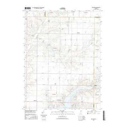
2016 Map of Bellmore
USGS Topo · Published 2016About this map
Big Raccoon Creek and the southern expanse of Cecil M Harden Lake dominate this West Central Indiana landscape, where the borders of Parke, Montgomery, and Putnam counties converge. The small settlement of Portland Mills sits at the eastern edge of the water, while the Portland Mills Bridge spans a northern tributary. This area is characterized by a high density of family-named burial grounds, including Seybold Cem, Bruin Cem, and Jarvis Cem, which provide significant genealogical value for researchers of early township families. Along the northern boundary, the town of Waveland serves as a local hub, while smaller crossroads like Hollandsburg, Bellmore, and Milligan anchor the agricultural grid. The drainage patterns of Little Raccoon Cr and its various forks illustrate the complex topography that defines the region's rural character.
Find a feature on this map
103 named features on this map. Tap any name to fly to it.
Don’t see what you’re looking for? This feature index may not catch every label — zoom into the map to look around manually.
Map Details
Editions of this 2016 Bellmore Map
This is the sole edition of this map. No revisions or reprints were ever made.
Other maps of this area

1948 · Wallace
USGS Topo · 1:24,000

1949 · Alamo
USGS Topo · 1:24,000

1951 · Clinton Falls
USGS Topo · 1:24,000

1951 · Mansfield
USGS Topo · 1:24,000

1952 · Catlin
USGS Topo · 1:24,000

1953 · Indianapolis
USGS Topo · 1:250,000

1955 · Rockville
USGS Topo · 1:24,000

1955 · Russellville
USGS Topo · 1:24,000

1956 · Indianapolis
USGS Topo · 1:250,000

1956 · New Market
USGS Topo · 1:24,000