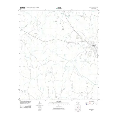
2010 Map of Bellville
USGS Topo · Published 2010About this map
Bellville serves as the primary urban center for this Austin County landscape, where the town's street grid meets a complex network of farm-to-market roads and creeks. The surrounding countryside is defined by its agricultural and industrial character, featuring the Nelsonville Gas Field and Millheim Gas Field, alongside the uniquely named Traylor Tick Farm Airport.
Find a feature on this map
58 named features on this map. Tap any name to fly to it.
Don’t see what you’re looking for? This feature index may not catch every label — zoom into the map to look around manually.
Map Details
Editions of this 2010 Bellville Map
This is the sole edition of this map. No revisions or reprints were ever made.
Other maps of this area

1930 · Brenham
USGS Topo · 1:62,500

1953 · Seguin
USGS Topo · 1:250,000

1954 · Austin
USGS Topo · 1:250,000

1956 · Bellville
USGS Topo · 1:62,500

1956 · Sealy
USGS Topo · 1:62,500

1956 · Hempstead
USGS Topo · 1:62,500

1956 · Brenham
USGS Topo · 1:62,500

1958 · Seguin
USGS Topo · 1:250,000

1958 · Bernardo
USGS Topo · 1:24,000
1960 · Sealy
USGS Topo · 1:24,000