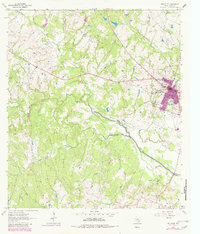
1963 Map of Bellville
USGS Topo · Published 1982About this map
The town of Bellville anchors this survey of Austin County, showing its growth along the Atchison Topeka and Santa Fe railroad corridor. The landscape is defined by the convergence of several major waterways, including Mill Creek, Sandy Creek, and Piney Creek, which carved the terrain long before modern development. In the southern portion of the map, the industrial footprint of the Millheim Gas Field is evident, marked by numerous drill holes and gas wells that signify the region's energy production in the early 1960s.
Find a feature on this map
31 named features on this map. Tap any name to fly to it.
Don’t see what you’re looking for? This feature index may not catch every label — zoom into the map to look around manually.
Map Details
Editions of this 1963 Bellville Map
This is the sole edition of this map. No revisions or reprints were ever made.
Other maps of this area

1930 · Brenham
USGS Topo · 1:62,500

1953 · Seguin
USGS Topo · 1:250,000

1954 · Austin
USGS Topo · 1:250,000

1956 · Bellville
USGS Topo · 1:62,500

1956 · Sealy
USGS Topo · 1:62,500

1956 · Hempstead
USGS Topo · 1:62,500

1956 · Brenham
USGS Topo · 1:62,500

1958 · Seguin
USGS Topo · 1:250,000

1958 · Bernardo
USGS Topo · 1:24,000
1960 · Sealy
USGS Topo · 1:24,000