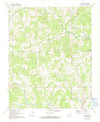
1971 Map of Bellvue
USGS Topo · Published 1991About this map
Lake Heyburn dominates the eastern edge of this landscape, its waters reaching into the winding drainages of Mosquito Creek and Whiskey Branch. The area represents a transition between the elevated uplands of the Olive and Hazelip districts and the river valleys to the south. An extensive network of oil fields and scattered oil wells punctuates the terrain, particularly around the headwaters of Dog Creek and Polecat Creek, illustrating the region's mid-century petroleum economy.
Find a feature on this map
23 named features on this map. Tap any name to fly to it.
Don’t see what you’re looking for? This feature index may not catch every label — zoom into the map to look around manually.
Map Details
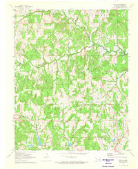
Editions of this 1971 Bellvue Map
2 editions found
Other maps of this area

1901 · Nuyaka
USGS Topo · 1:125,000

1912 · Hominy
USGS Topo · 1:125,000

1915 · Hominy
USGS Topo · 1:125,000

1916 · Bristow
USGS Topo · 1:62,500

1929 · Yale
USGS Topo · 1:62,500

1931 · Drumright
USGS Topo · 1:62,500

1932 · Yale
USGS Topo · 1:62,500

1954 · Oklahoma City
USGS Topo · 1:250,000

1955 · Enid
USGS Topo · 1:250,000

1957 · Oklahoma City
USGS Topo · 1:250,000