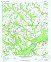
1957 Map of Bellwood
USGS Topo · Published 1981About this map
The Choctawhatchee River meanders across the southern portion of this landscape, its wide floodplain punctuated by active sandpits near the settlement of Bellwood. This 1957 survey, updated with late-twentieth-century revisions, reveals a rural community structured around its watercourses and country congregations. Numerous small creeks like Sardis Creek, Wilkerson Creek, and Bronson Creek feed the larger river system, defining the agricultural and timbered parcels of the region.
Find a feature on this map
35 named features on this map. Tap any name to fly to it.
Don’t see what you’re looking for? This feature index may not catch every label — zoom into the map to look around manually.
Map Details
Editions of this 1957 Bellwood Map
2 editions found

Other maps of this area

1942 · Enterprise
USGS Topo · 1:125,000

1948 · Ozark
USGS Topo · 1:62,500

1950 · Ozark
USGS Topo · 1:62,500

1950 · Enterprise
USGS Topo · 1:62,500

1953 · Dothan
USGS Topo · 1:250,000

1954 · Dothan
USGS Topo · 1:250,000

1955 · Dothan
USGS Topo · 1:250,000

1957 · Geneva
USGS Topo · 1:62,500

1957 · Hartford
USGS Topo · 1:62,500
1957 · Hartford
USGS Topo · 1:24,000