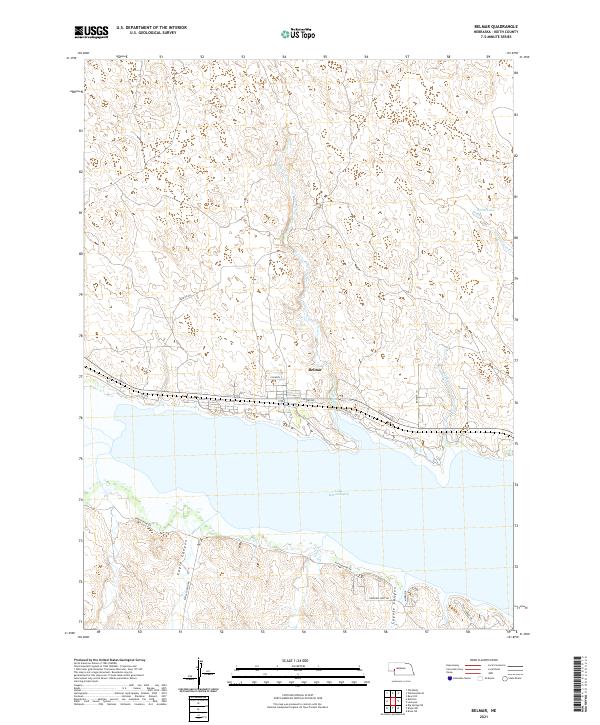
2021 Map of Belmar
USGS Topo · Published 2021About this map
Belmar sits along the northern shore of Lake McConaughy in the Nebraska Sandhills, serving as a primary point of reference for this lakefront landscape. The terrain is defined by the sharp transition from the elevated plains of the north to the dramatic canyon breaks of Eagle Canyon and Coyote Canyon along the southern banks. Water management and recreational infrastructure dominate the shoreline, evidenced by localized developments such as Fischers 2 and residential connectors like Lakeview West Rd and Light House Rd. Several drainages including Otter Cr and Lonergan Cr feed into the reservoir from the north, cutting through the section lines of Keith County. This survey provides a contemporary view of the region's rural road network, from Patrick Rd to the various lakeside subdivisions that have shaped the contemporary character of this Keith County shoreline.
Find a feature on this map
25 named features on this map. Tap any name to fly to it.
Don’t see what you’re looking for? This feature index may not catch every label — zoom into the map to look around manually.
Map Details
Editions of this 2021 Belmar Map
This is the sole edition of this map. No revisions or reprints were ever made.
Other maps of this area

1897 · Ogallala
USGS Topo · 1:125,000

1900 · Chappell
USGS Topo · 1:125,000

1900 · Ogallala
USGS Topo · 1:125,000

1954 · Scottsbluff
USGS Topo · 1:250,000

1954 · North Platte
USGS Topo · 1:250,000

1956 · North Platte
USGS Topo · 1:250,000

1957 · North Platte
USGS Topo · 1:250,000

1958 · Scottsbluff
USGS Topo · 1:250,000

1967 · North Platte
USGS Topo · 1:250,000
1971 · Brule NW
USGS Topo · 1:24,000