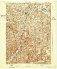
1925 Map of Belmont
USGS Topo · Published 1932About this map
Belmont and the surrounding Allegany County hills are defined by the narrow river valleys and high ridges that shaped early transportation in the Southern Tier. The Genesee River carves through the northeast, shadowed by the Erie R R, while the Liberty Highway cuts across the northern townships through Friendship. This area reveals a dense network of early 20th-century rural life, evidenced by the numerous district schools like Moulton School and Pine Grove School that dotted every township from Cuba to Alma.
Find a feature on this map
95 named features on this map. Tap any name to fly to it.
Don’t see what you’re looking for? This feature index may not catch every label — zoom into the map to look around manually.
Map Details
Editions of this 1925 Belmont Map
4 editions found
Other maps of this area

1898 · Olean
USGS Topo · 1:62,500

1906 · Angelica
USGS Topo · 1:62,500

1916 · Canaseraga
USGS Topo · 1:62,500

1924 · Franklinville
USGS Topo · 1:62,500

1925 · Belmont
USGS Topo · 1:62,500

1926 · Wellsville
USGS Topo · 1:62,500

1932 · Genesee
USGS Topo · 1:62,500

1933 · Smethport
USGS Topo · 1:62,500

1934 · Coudersport
USGS Topo · 1:48,000

1937 · Genesee
USGS Topo · 1:62,500