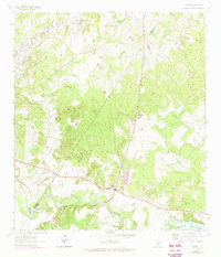
1964 Map of Belmont
USGS Topo · Published 1975About this map
The small community of Belmont sits at a strategic crossroads in western Gonzales County, where state highways intersect north of a wide bend in the Guadalupe River. This 1964 survey captures the landscape as it transitioned from traditional river-valley agriculture to petroleum extraction, evidenced by the Darst Oil Fields and numerous pipelines that cut across the local topography. The river plain is a focal point of activity, featuring Lake Gonzales and the industrial footprint of a Gravel Pit.
Find a feature on this map
19 named features on this map. Tap any name to fly to it.
Don’t see what you’re looking for? This feature index may not catch every label — zoom into the map to look around manually.
Map Details
Editions of this 1964 Belmont Map
3 editions found
Other maps of this area

1911 · San Marcos
USGS Topo · 1:125,000

1919 · San Marcos
USGS Topo · 1:125,000

1920 · Smiley
USGS Topo · 1:125,000

1924 · San Marcos 3-d
USGS Topo · 1:48,000

1925 · San Marcos 4-c
USGS Topo · 1:48,000

1925 · San Marcos 4-a
USGS Topo · 1:48,000

1929 · Luling
USGS Topo · 1:62,500

1930 · Seguin
USGS Topo · 1:62,500

1942 · Dewville
USGS Topo · 1:62,500

1953 · Seguin
USGS Topo · 1:250,000