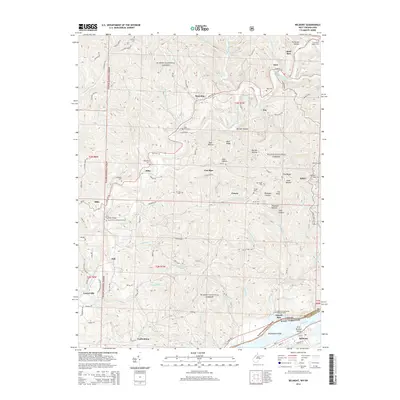
2014 Map of Belmont
USGS Topo · Published 2014About this map
Wayne National Forest covers much of this landscape, where the Ohio River forms the state boundary between Ohio and West Virginia. This river corridor features Broadback Island and First Brother Island, marking the southeastern edge of the map near Belmont. The area is characterized by a dense network of small settlements and family-named landmarks, many tied to the local cemeteries that provide vital records for genealogists. Notable sites include the Old Dutch Cem, Lawrence Baptist Cem, and Beech Grove United Brethren Cem. Smaller communities like Steel Run, Sitka, and Yankeeburg are connected by narrow valley roads such as Dauts Hill Rd and Zion Ridge Rd, which follow the winding drainages of Little Muskingum River and Archers Fork. The terrain is defined by numerous hollows, including Patterson Hollow and Pheasant Hollow.
Find a feature on this map
115 named features on this map. Tap any name to fly to it.
Don’t see what you’re looking for? This feature index may not catch every label — zoom into the map to look around manually.
Map Details
Editions of this 2014 Belmont Map
This is the sole edition of this map. No revisions or reprints were ever made.
Other maps of this area

1903 · Macksburg
USGS Topo · 1:62,500

1904 · Marietta
USGS Topo · 1:62,500

1905 · New Matamoras
USGS Topo · 1:62,500

1905 · Macksburg
USGS Topo · 1:62,500

1906 · Saint Marys
USGS Topo · 1:62,500

1924 · St Marys
USGS Topo · 1:62,500

1924 · New Matamoras
USGS Topo · 1:62,500

1924 · Marietta
USGS Topo · 1:62,500

1926 · New Matamoras
USGS Topo · 1:62,500

1927 · Marietta
USGS Topo · 1:62,500