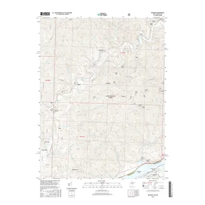
2016 Map of Belmont
USGS Topo · Published 2016About this map
The Little Muskingum River winds through the northern half of this landscape, passing through the Wayne National Forest and the communities of Moss Run and Sitka. This area along the border of Washington County, Ohio, and Pleasants County, West Virginia, is defined by its numerous family and church burial grounds, reflecting generations of local settlement. Genealogists can find the Old Dutch Cem, Ludwig Cem, and Beech Grove Presbyterian Cem scattered across the ridges. Further south, the Ohio River forms the state boundary, featuring Broadback Island and First Brother Island. The riverfront includes the town of Belmont, where Newell Run meets the larger waterway. The map captures a detailed view of the rural road network, from Stanleyville Rd to the trails of NCT Marietta S, connecting small hubs like Cornerville and Yankeeburg.
Find a feature on this map
94 named features on this map. Tap any name to fly to it.
Don’t see what you’re looking for? This feature index may not catch every label — zoom into the map to look around manually.
Map Details
Editions of this 2016 Belmont Map
This is the sole edition of this map. No revisions or reprints were ever made.
Other maps of this area

1903 · Macksburg
USGS Topo · 1:62,500

1904 · Marietta
USGS Topo · 1:62,500

1905 · New Matamoras
USGS Topo · 1:62,500

1905 · Macksburg
USGS Topo · 1:62,500

1906 · Saint Marys
USGS Topo · 1:62,500

1924 · St Marys
USGS Topo · 1:62,500

1924 · New Matamoras
USGS Topo · 1:62,500

1924 · Marietta
USGS Topo · 1:62,500

1926 · New Matamoras
USGS Topo · 1:62,500

1927 · Marietta
USGS Topo · 1:62,500