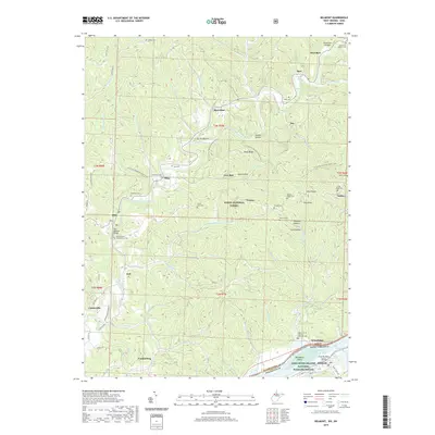
2019 Map of Belmont
USGS Topo · Published 2019About this map
The Little Muskingum River meanders through a landscape defined by deep valleys and high ridges in the southeast corner of Ohio, just across the water from Belmont, West Virginia. This area is characterized by scattered rural settlements like Sitka, Moss Run, and Fay, which are connected by winding roads and the N Country National Scenic Trail. The dense woodlands of the Wayne National Forest dominate the central terrain, while the southern boundary is marked by the broad Ohio River.
Find a feature on this map
97 named features on this map. Tap any name to fly to it.
Don’t see what you’re looking for? This feature index may not catch every label — zoom into the map to look around manually.
Map Details
Editions of this 2019 Belmont Map
This is the sole edition of this map. No revisions or reprints were ever made.
Other maps of this area

1903 · Macksburg
USGS Topo · 1:62,500

1904 · Marietta
USGS Topo · 1:62,500

1905 · New Matamoras
USGS Topo · 1:62,500

1905 · Macksburg
USGS Topo · 1:62,500

1906 · Saint Marys
USGS Topo · 1:62,500

1924 · St Marys
USGS Topo · 1:62,500

1924 · New Matamoras
USGS Topo · 1:62,500

1924 · Marietta
USGS Topo · 1:62,500

1926 · New Matamoras
USGS Topo · 1:62,500

1927 · Marietta
USGS Topo · 1:62,500