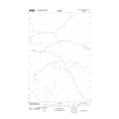
2011 Map of Belmore Sloughs
USGS Topo · Published 2011About this map
The North Fork Jocko River, Middle Fork Jocko River, and South Fork Jocko River converge within this high-elevation landscape, forming a complex watershed in Missoula County. The topography is defined by significant water features, including the sprawling Belmore Sloughs and isolated bodies such as White Horse Lake and Meadow Lake. Human impact on the hydrology is evident at the Jocko Dam, which regulates Jocko Lake at the eastern edge of the quadrangle.
Find a feature on this map
18 named features on this map. Tap any name to fly to it.
Don’t see what you’re looking for? This feature index may not catch every label — zoom into the map to look around manually.
Map Details
Editions of this 2011 Belmore Sloughs Map
This is the sole edition of this map. No revisions or reprints were ever made.
Other maps of this area

1921 · Elbow Lake
USGS Topo · 1:125,000

1955 · Choteau
USGS Topo · 1:250,000

1957 · Choteau
USGS Topo · 1:250,000

1958 · Choteau
USGS Topo · 1:250,000

1962 · Choteau
USGS Topo · 1:250,000

1965 · Upper Jocko Lake
USGS Topo · 1:24,000
1965 · Belmore Sloughs
USGS Topo · 1:24,000
1965 · Gold Creek Peak
USGS Topo · 1:24,000
1965 · Stuart Peak
USGS Topo · 1:24,000

1965 · Gray Wolf Lake
USGS Topo · 1:24,000