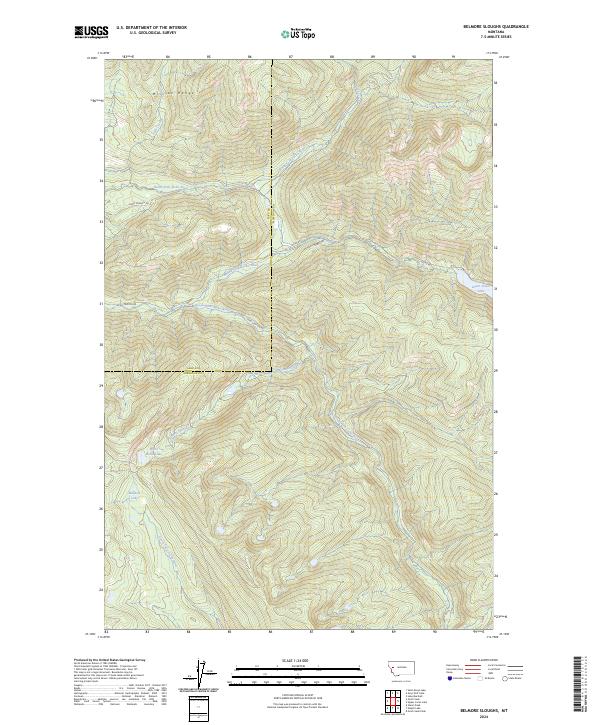
2024 Map of Belmore Sloughs
USGS Topo · Published 2024About this map
The Mission Range towers over a landscape defined by the convergence of mountain waters in this remote part of Montana. The drainage system is particularly prominent, featuring the North Fork Jocko River, Middle Fork Jocko River, and South Fork Jocko River as they carve through steep topography. These waterways are joined by several high-elevation tributaries such as Falls Creek and Deep Creek, highlighting the complex hydrology of the region.
Find a feature on this map
25 named features on this map. Tap any name to fly to it.
Don’t see what you’re looking for? This feature index may not catch every label — zoom into the map to look around manually.
Map Details
Editions of this 2024 Belmore Sloughs Map
This is the sole edition of this map. No revisions or reprints were ever made.
Other maps of this area

1921 · Elbow Lake
USGS Topo · 1:125,000

1955 · Choteau
USGS Topo · 1:250,000

1957 · Choteau
USGS Topo · 1:250,000

1958 · Choteau
USGS Topo · 1:250,000

1962 · Choteau
USGS Topo · 1:250,000

1965 · Upper Jocko Lake
USGS Topo · 1:24,000
1965 · Belmore Sloughs
USGS Topo · 1:24,000
1965 · Gold Creek Peak
USGS Topo · 1:24,000
1965 · Stuart Peak
USGS Topo · 1:24,000

1965 · Gray Wolf Lake
USGS Topo · 1:24,000