
1955 Map of Beloit
USGS Topo · Published 1971About this map
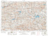
Nicodemus stands as a significant historical point on this 1955 survey, reflecting the deep settlement roots of North Central Kansas. The landscape is defined by the parallel paths of the North Fork Solomon River, South Fork Solomon River, and the Saline River, which carve through the plains to support a network of small agricultural towns. Major mid-century water management projects are evident in the presence of the Kirwin Reservoir, Webster Reservoir, and the Glen Elder Res, which had recently altered the local hydrology and created new recreational areas like Webster State Park. This era shows the region still heavily reliant on its rail infrastructure, with lines from the Union Pacific, Missouri Pacific, and the Atchison Topeka and Santa Fe connecting trade centers like Beloit, Osborne, and Norton to the broader American economy.
Find a feature on this map
107 named features on this map. Tap any name to fly to it.
Don’t see what you’re looking for? This feature index may not catch every label — zoom into the map to look around manually.
Map Details
Editions of this 1955 Beloit Map
3 editions found
Other maps of this area

1892 · Concordia
USGS Topo · 1:125,000

1892 · Salina
USGS Topo · 1:125,000

1892 · Minneapolis
USGS Topo · 1:125,000

1893 · Ellis
USGS Topo · 1:125,000

1893 · Smith Center
USGS Topo · 1:125,000

1893 · Norton
USGS Topo · 1:125,000

1893 · Phillipsburg
USGS Topo · 1:125,000

1893 · Hill
USGS Topo · 1:125,000

1894 · Ellsworth
USGS Topo · 1:125,000

1894 · Mankato
USGS Topo · 1:125,000