
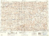
1959 Map of Beloit
USGS Topo · Published 1959About this map
The South Fork Solomon River and North Fork Solomon River dominate the landscape of north-central Kansas during a period of significant water management. This 1959 survey records a pivotal moment for the region as the Kirwin Res and Webster Dam are noted as being under construction, infrastructure projects that would permanently alter the drainage of the Solomon River valley. These developments stand alongside a well-established agricultural and industrial footprint, characterized by numerous active petroleum sites including the Bemis-Shutts Oil Field and Kruger Oil Field.
Find a feature on this map
119 named features on this map. Tap any name to fly to it.
Don’t see what you’re looking for? This feature index may not catch every label — zoom into the map to look around manually.
Map Details
Editions of this 1959 Beloit Map
3 editions found

Other maps of this area

1892 · Concordia
USGS Topo · 1:125,000

1892 · Salina
USGS Topo · 1:125,000

1892 · Minneapolis
USGS Topo · 1:125,000

1893 · Ellis
USGS Topo · 1:125,000

1893 · Smith Center
USGS Topo · 1:125,000

1893 · Norton
USGS Topo · 1:125,000

1893 · Phillipsburg
USGS Topo · 1:125,000

1893 · Hill
USGS Topo · 1:125,000

1894 · Ellsworth
USGS Topo · 1:125,000

1894 · Mankato
USGS Topo · 1:125,000