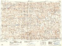
1959 Map of Beloit
USGS Topo · Published 1959About this map
The North Fork Solomon River and South Fork Solomon River dominate the northern Kansas landscape during this late 1950s survey. This period reflects a significant era of water management and industrial expansion, marked by the recent completion of the Webster Dam creating the Webster Reservoir, along with the Kirwin Reservoir and Lovewell Reservoir. These massive projects altered the local geography, providing irrigation and flood control for the agricultural communities of Beloit, Stockton, and Phillipsburg.
Find a feature on this map
107 named features on this map. Tap any name to fly to it.
Don’t see what you’re looking for? This feature index may not catch every label — zoom into the map to look around manually.
Map Details
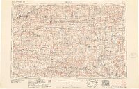
Editions of this 1959 Beloit Map
3 editions found

Other maps of this area

1892 · Concordia
USGS Topo · 1:125,000

1892 · Salina
USGS Topo · 1:125,000

1892 · Minneapolis
USGS Topo · 1:125,000

1893 · Ellis
USGS Topo · 1:125,000

1893 · Smith Center
USGS Topo · 1:125,000

1893 · Norton
USGS Topo · 1:125,000

1893 · Phillipsburg
USGS Topo · 1:125,000

1893 · Hill
USGS Topo · 1:125,000

1894 · Ellsworth
USGS Topo · 1:125,000

1894 · Mankato
USGS Topo · 1:125,000