
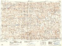
1959 Map of Beloit
USGS Topo · Published 1959About this map
The North Fork Solomon River and South Fork Solomon River define the mid-century landscape of North Central Kansas, feeding into significant water management projects of the era. The Kirwin Res and the newly completed Webster Dam backing the Webster Res illustrate the large-scale hydrologic changes occurring in the late 1950s. This survey, compiled from 1955 photogrammetry, documents the region's dense rail network, including the Union Pacific RR, Chicago Rock Island and Pacific RR, and Missouri Pacific RR, which connected agricultural hubs like Beloit, Phillipsburg, and Norton. Beyond the river valleys and rail lines, the map traces the high plains terrain toward landmarks like Blue Mound and numerous small settlements such as Esbon, Athol, and Luray that served as local centers for the surrounding farmsteads and ranchlands.
Find a feature on this map
102 named features on this map. Tap any name to fly to it.
Don’t see what you’re looking for? This feature index may not catch every label — zoom into the map to look around manually.
Map Details
Editions of this 1959 Beloit Map
3 editions found

Other maps of this area

1892 · Concordia
USGS Topo · 1:125,000

1892 · Salina
USGS Topo · 1:125,000

1892 · Minneapolis
USGS Topo · 1:125,000

1893 · Ellis
USGS Topo · 1:125,000

1893 · Smith Center
USGS Topo · 1:125,000

1893 · Norton
USGS Topo · 1:125,000

1893 · Phillipsburg
USGS Topo · 1:125,000

1893 · Hill
USGS Topo · 1:125,000

1894 · Ellsworth
USGS Topo · 1:125,000

1894 · Mankato
USGS Topo · 1:125,000