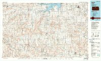
1985 Map of Beloit
USGS Topo · Published 1990About this map
Waconda Lake dominates the northern horizon of this North Central Kansas landscape, where the damming of the Solomon River fundamentally altered the local geography. The map illustrates a strictly organized agricultural grid, punctuated by vital transportation hubs like the Missouri Pacific RR and numerous landing strips, including the Tipton Landing Strip and Vesper Landing Field. These features highlight the reliance on both rail and small-craft aviation to bridge the distances between rural communities such as Osborne, Lincoln, and Cawker City. A notable institutional landmark is the State Girls Industrial School located on the outskirts of Beloit, providing a specific point of interest for social historians. Large conservation tracts like the Glen Elder State Wildlife Area and Wilson State Wildlife Area border the water bodies, marking a transition from traditional farming to managed natural spaces.
Find a feature on this map
107 named features on this map. Tap any name to fly to it.
Don’t see what you’re looking for? This feature index may not catch every label — zoom into the map to look around manually.
Map Details
Editions of this 1985 Beloit Map
2 editions found
Other maps of this area

1892 · Concordia
USGS Topo · 1:125,000

1892 · Salina
USGS Topo · 1:125,000

1892 · Minneapolis
USGS Topo · 1:125,000

1893 · Smith Center
USGS Topo · 1:125,000

1893 · Phillipsburg
USGS Topo · 1:125,000

1894 · Ellsworth
USGS Topo · 1:125,000

1894 · Mankato
USGS Topo · 1:125,000

1894 · Beloit
USGS Topo · 1:125,000

1896 · Osborne
USGS Topo · 1:125,000

1896 · Russell
USGS Topo · 1:125,000