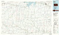
1985 Map of Beloit
USGS Topo · Published 1985About this map
Waconda Lake and the Glen Elder State Wildlife Area dominate the northern landscape of North Central Kansas in this mid-1980s survey. The region is defined by the forks of the Solomon River, with the North Fork Solomon River and South Fork Solomon River converging near the prominent settlement of Beloit. This era shows a mature agricultural and transport network, featuring a dense grid of section roads and several active rail lines, including the Missouri Pacific RR and the Union Pacific RR.
Find a feature on this map
85 named features on this map. Tap any name to fly to it.
Don’t see what you’re looking for? This feature index may not catch every label — zoom into the map to look around manually.
Map Details
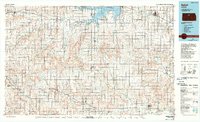
Editions of this 1985 Beloit Map
2 editions found
Other maps of this area

1892 · Concordia
USGS Topo · 1:125,000

1892 · Salina
USGS Topo · 1:125,000

1892 · Minneapolis
USGS Topo · 1:125,000

1893 · Smith Center
USGS Topo · 1:125,000

1893 · Phillipsburg
USGS Topo · 1:125,000

1894 · Ellsworth
USGS Topo · 1:125,000

1894 · Mankato
USGS Topo · 1:125,000

1894 · Beloit
USGS Topo · 1:125,000

1896 · Osborne
USGS Topo · 1:125,000

1896 · Russell
USGS Topo · 1:125,000