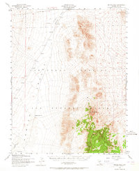
1952 Map of Belted Peak
USGS Topo · Published 1964About this map
Las Vegas Bombing Range dominates this mid-century landscape, a restricted military expanse in the high desert of Nye County. The survey reveals a terrain defined by the contrast between the flat floor of the Kawich Valley and the jagged elevation of the Belted Range. Civilian interests appear on the margins or in the past, indicated by the Oswald Mine in the northeast and an Abandoned Landing Strip near the valley floor. Water sources are scarce and critical, limited to isolated points like Cliff Spring, Lambs Pond, and the Antelope Reservoir. The map illustrates the region's transition into a secure weapons testing area, where traditional mining activity was superseded by military requirements, evidenced by various Target markers positioned throughout the sector.
Find a feature on this map
12 named features on this map. Tap any name to fly to it.
Don’t see what you’re looking for? This feature index may not catch every label — zoom into the map to look around manually.
Map Details
Editions of this 1952 Belted Peak Map
3 editions found

Other maps of this area

1908 · Kawich
USGS Topo · 1:250,000

1942 · Emigrant Valley
USGS Topo · 1:125,000

1942 · Reveille Peak
USGS Topo · 1:125,000

1942 · Wheelbarrow Peak
USGS Topo · 1:125,000

1942 · Penoyer Valley
USGS Topo · 1:125,000

1952 · Kawich Peak
USGS Topo · 1:62,500

1952 · Quartzite Mtn
USGS Topo · 1:62,500

1952 · White Blotch Springs
USGS Topo · 1:62,500

1952 · Reveille Peak
USGS Topo · 1:62,500

1952 · Wheelbarrow Peak
USGS Topo · 1:62,500