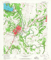
1965 Map of Belton
USGS Topo · Published 1968About this map
The Leon River and Lampasas River converge in this Bell County landscape, shaped by the mid-century engineering of the Belton Reservoir. The 1960s footprint of Belton shows a concentrated downtown core giving way to emerging residential developments like Miller Heights and Leon Heights. The western edge of Temple enters the frame from the east, connected by the heavy rail lines of the Atchison Topeka and Santa Fe. Local institutions and rural anchors are well-represented, including the Taylors Valley Ch, Cater Sch, and the North Belton Cem. Military and recreational activity is evident at Camp Kinsolving and several riverside parks. The presence of numerous Gravel Pits along the riverbanks points to the area's extractive industry supporting regional growth during this period.
Find a feature on this map
63 named features on this map. Tap any name to fly to it.
Don’t see what you’re looking for? This feature index may not catch every label — zoom into the map to look around manually.
Map Details
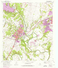
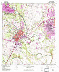
Editions of this 1965 Belton Map
3 editions found
Other maps of this area

1885 · Taylor
USGS Topo · 1:125,000

1887 · Taylor
USGS Topo · 1:125,000

1892 · Temple
USGS Topo · 1:125,000

1893 · Georgetown
USGS Topo · 1:125,000

1894 · Gatesville
USGS Topo · 1:125,000

1894 · Taylor
USGS Topo · 1:125,000

1924 · Gatesville 4-d
USGS Topo · 1:48,000

1924 · Gatesville 4-a
USGS Topo · 1:48,000

1924 · Temple 3-C
USGS Topo · 1:48,000

1924 · Temple 3-B
USGS Topo · 1:48,000