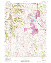
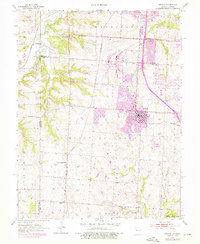
1953 Map of Belton
USGS Topo · Published 1971About this map
Richards-Gebaur Air Force Base dominates the center of this landscape, reflecting the significant Cold War military presence along the Missouri-Kansas border. The core of Belton and nearby Grandview show substantial growth, with purple revisions highlighting the rapid suburbanization occurring between the original 1953 field check and 1970. This period of expansion is contrasted by the established agricultural and industrial patterns of the surrounding countryside, where the Knoche Oil Field and various rural schools like Mt Pleasant Sch and Westover Sch remain visible.
Find a feature on this map
26 named features on this map. Tap any name to fly to it.
Don’t see what you’re looking for? This feature index may not catch every label — zoom into the map to look around manually.
Map Details
Editions of this 1953 Belton Map
5 editions found
Other maps of this area

1887 · Harrisonville
USGS Topo · 1:125,000

1887 · Olathe
USGS Topo · 1:125,000

1892 · Harrisonville
USGS Topo · 1:125,000

1893 · Olathe
USGS Topo · 1:125,000

1894 · Harrisonville
USGS Topo · 1:125,000

1934 · Grandview
USGS Topo · 1:24,000

1934 · Lees Summit
USGS Topo · 1:24,000

1935 · Lenexa
USGS Topo · 1:24,000

1939 · Grandview
USGS Topo · 1:31,680

1939 · Lees Summit
USGS Topo · 1:31,680