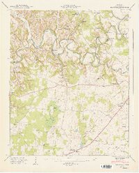
1947 Map of Belvidere
USGS Topo · Published 1948About this map
Elk River serpentines through the northern half of this landscape, its deep meanders creating distinct landmarks like Maple Bend and The Loop. The river is crossed by several named spans, including Willis Lake Bridge and Mansford Bridge, suggesting a well-connected rural economy just after the war. Inland from the river, the terrain shifts from the high ground of Highland Ridge to the low-lying Mingo Swamp and Mingo Pond.
Find a feature on this map
64 named features on this map. Tap any name to fly to it.
Don’t see what you’re looking for? This feature index may not catch every label — zoom into the map to look around manually.
Map Details
Editions of this 1947 Belvidere Map
4 editions found
Other maps of this area

1928 · Decherd
USGS Topo · 1:62,500

1936 · Cumberland Springs
USGS Topo · 1:24,000

1936 · Beans Creek
USGS Topo · 1:24,000

1936 · Winchester
USGS Topo · 1:24,000

1936 · Huntland
USGS Topo · 1:24,000

1936 · Belvidere
USGS Topo · 1:24,000

1936 · Pitcher Ridge
USGS Topo · 1:24,000

1936 · Camp Peay
USGS Topo · 1:24,000

1936 · Capitol Hill
USGS Topo · 1:24,000

1936 · Lois
USGS Topo · 1:24,000