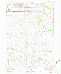
1968 Map of Belvidere South
USGS Topo · Published 1981About this map
Belvidere serves as the primary urban anchor at the northern edge of this landscape, where the Northwest Tollway bisects the rural expanses of Bonus and Spring townships. The map documents a transition in mid-century local entertainment and social life, featuring both a Drive-in Theater and a Grange Hall. This region is characterized by its agricultural heritage and early infrastructure, evidenced by the crossing of the Illinois Central railroad and a grid of secondary routes like Bloods Point Road and Fern Hill Road. Genealogists will find significant value in the documentation of local burial grounds, including Shattucks Grove Cem and Bloods Point Cem, while the presence of numerous Gravel Pits suggests the importance of local mineral extraction to the area's development during the late 1960s.
Find a feature on this map
35 named features on this map. Tap any name to fly to it.
Don’t see what you’re looking for? This feature index may not catch every label — zoom into the map to look around manually.
Map Details
Editions of this 1968 Belvidere South Map
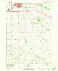
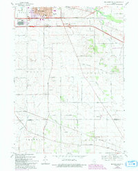
3 editions found
Other maps of this area

1918 · Belvidere
USGS Topo · 1:62,500

1918 · Kirkland
USGS Topo · 1:62,500

1932 · Harvard
USGS Topo · 1:48,000

1937 · Harvard
USGS Topo · 1:62,500

1938 · Genoa
USGS Topo · 1:62,500

1944 · Belvidere
USGS Topo · 1:62,500

1954 · Rockford
USGS Topo · 1:250,000

1955 · Rockford
USGS Topo · 1:250,000

1958 · Rockford
USGS Topo · 1:250,000

1963 · Rockford
USGS Topo · 1:250,000