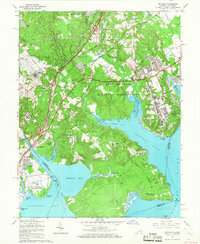
1965 Map of Belvoir
USGS Topo · Published 1967About this map
Fort Belvoir Military Reservation dominates the landscape at the confluence of the Potomac River and several major inlets, including Gunston Cove and Belmont Bay. The area showcases a mix of mid-century military infrastructure and deep colonial roots, notably at Gunston Hall and Woodlawn Plantation. Transportation is a primary theme of the terrain, with the Richmond Fredericksburg and Potomac Railroad and the Shirley Memorial Highway cutting through the forest and suburban growth. The map captures local landmarks such as Pohick Ch and the Remey Tomb, alongside the developing residential enclaves of Hunter Estates and Pohick Estates. Along the Occoquan Creek, the settlement of Woodbridge stands across the water from the historic site of Colchester, illustrating the transition of Northern Virginia from a plantation-based river economy to a modern military and suburban hub.
Find a feature on this map
73 named features on this map. Tap any name to fly to it.
Don’t see what you’re looking for? This feature index may not catch every label — zoom into the map to look around manually.
Map Details
Editions of this 1965 Belvoir Map
4 editions found
Other maps of this area

1890 · Mt. Vernon
USGS Topo · 1:125,000

1891 · Mt. Vernon
USGS Topo · 1:125,000

1894 · Mt. Vernon
USGS Topo · 1:125,000

1897 · Mt. Vernon
USGS Topo · 1:125,000

1900 · Washington
USGS Topo · 1:62,500

1913 · Indian Head
USGS Topo · 1:62,500

1915 · Fairfax
USGS Topo · 1:62,500

1923 · Indian Head
USGS Topo · 1:48,000

1925 · Indian Head
USGS Topo · 1:62,500

1927 · Quantico
USGS Topo · 1:62,500