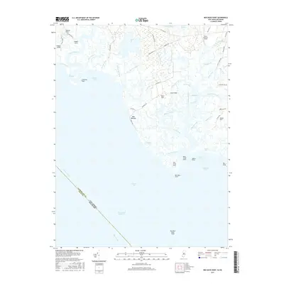
2017 Map of Ben Davis Point
USGS Topo · Published 2017About this map
Sea Breeze and the surrounding coastal marshlands of Cumberland County dominate this 2017 survey where the Delaware Bay meets the New Jersey shoreline. The landscape is a complex network of tidal waterways and salt marshes, defined by the winding course of the Cohansey River as it passes Cohansey Point into Cohansey Cove. The settlement pattern follows the higher ground of the "necks," including Bacons Neck, Back Neck, and Sayres Neck, which are separated by vast wetlands and creeks such as Middle Marsh Creek and Back Creek.
Find a feature on this map
64 named features on this map. Tap any name to fly to it.
Don’t see what you’re looking for? This feature index may not catch every label — zoom into the map to look around manually.
Map Details
Editions of this 2017 Ben Davis Point Map
This is the sole edition of this map. No revisions or reprints were ever made.
Other maps of this area

1890 · Maurice Cove
USGS Topo · 1:62,500

1890 · Bay Side
USGS Topo · 1:62,500

1890 · Bridgeton
USGS Topo · 1:62,500

1891 · Maurice Cove
USGS Topo · 1:62,500

1894 · Bay Side
USGS Topo · 1:62,500

1894 · Bridgeton
USGS Topo · 1:62,500

1899 · Vineland
USGS Topo · 1:125,000

1919 · Vineland
USGS Topo · 1:125,000
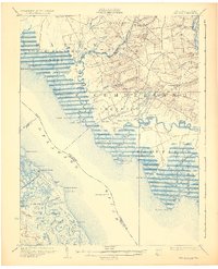
1931 · Bay Side
USGS Topo · 1:62,500

1934 · Bowers
USGS Topo · 1:48,000
Featured Places
- Fairfield Township, NJ
- Hopewell Township, NJ
- Lawrence Township, NJ
- Greenwich Township, NJ
- Husted Landing, Fairfield Township