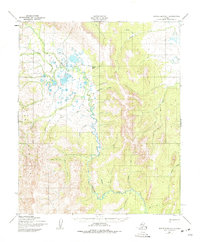
1950 Map of Bendeleben A-1
USGS Topo · Published 1975About this map
Death Valley dominates the northern landscape of this region, where the Tubutulik River begins its winding course southward through the Darby Mountains. The terrain is characterized by a complex network of waterways, including Copper Creek, Granite Creek, and Moonlight Creek, which drain the surrounding highlands. This area of the Seward Peninsula was mapped during the mid-20th century, capturing a remote interior landscape defined by seasonal travel routes and small outposts. Notable points of human activity are sparse, centered on the small settlement of Haven and the nearby Camp Haven. A long Winter Trail cuts across the wetlands and valleys, providing a vital connection through the wilderness before more permanent infrastructure reached this part of the territory. Researchers can observe the natural drainage patterns of tributaries like Salmon Creek and Admiral Creek as they feed into the larger river systems toward the coast.
Find a feature on this map
23 named features on this map. Tap any name to fly to it.
Don’t see what you’re looking for? This feature index may not catch every label — zoom into the map to look around manually.
Map Details
Editions of this 1950 Bendeleben A-1 Map
3 editions found
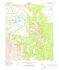
Other maps of this area

1948 · Norton Bay
USGS Topo · 1:250,000

1950 · Bendeleben B-2
USGS Topo · 1:63,360

1950 · Bendeleben B-1
USGS Topo · 1:63,360

1950 · Bendeleben A-2
USGS Topo · 1:63,360

1950 · Bendeleben A-1
USGS Topo · 1:63,360

1950 · Norton Bay D-6
USGS Topo · 1:63,360

1950 · Solomon D-2
USGS Topo · 1:63,360

1950 · Bendeleben
USGS Topo · 1:250,000

1950 · Solomon D-1
USGS Topo · 1:63,360

1950 · Solomon
USGS Topo · 1:250,000