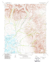
1950 Map of Bendeleben A-2
USGS Topo · Published 1987About this map
The Bendeleben Mountains and Darby Mountains dominate this high-latitude terrain on the Seward Peninsula, where sharp elevation gains from the coastal lowlands meet the interior peaks. Crucial transport routes are preserved here in the form of the Telephone Winter Trail, a historical lifeline across the tundra that once connected remote mining and reindeer herding outposts.
Find a feature on this map
22 named features on this map. Tap any name to fly to it.
Don’t see what you’re looking for? This feature index may not catch every label — zoom into the map to look around manually.
Map Details
Editions of this 1950 Bendeleben A-2 Map
3 editions found
Other maps of this area

1950 · Bendeleben B-2
USGS Topo · 1:63,360

1950 · Bendeleben A-3
USGS Topo · 1:63,360

1950 · Bendeleben B-1
USGS Topo · 1:63,360

1950 · Bendeleben A-2
USGS Topo · 1:63,360

1950 · Bendeleben A-1
USGS Topo · 1:63,360

1950 · Bendeleben B-3
USGS Topo · 1:63,360

1950 · Solomon D-2
USGS Topo · 1:63,360

1950 · Bendeleben
USGS Topo · 1:250,000

1950 · Solomon D-1
USGS Topo · 1:63,360

1950 · Solomon D-3
USGS Topo · 1:63,360