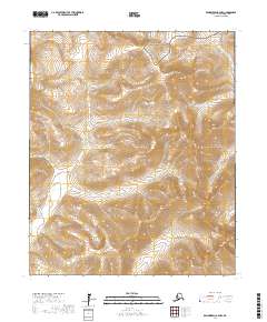
2017 Map of Bendeleben A-4 NW
USGS Topo · Published 2017About this map
Bering Land Bridge National Preserve occupies the northern reaches of this topographic survey, marking a protected landscape on the Seward Peninsula. The terrain is defined by a complex drainage system where the Niukluk River and Pargon River carve through high-elevation contours. In the southeast, the prominent peak of Chauik Mtn stands as a significant landmark overlooking a network of tributary streams. These waterways, including Nesbit Cr, Dillon Cr, and McKelvie Cr, illustrate the natural irrigation of this subarctic environment. The absence of roads or established settlements emphasizes the remote, undeveloped character of the region in the early 21st century, where land management boundaries like t3s r26w and 4s r25w provide the only human-imposed structure to the wilderness.
Find a feature on this map
14 named features on this map. Tap any name to fly to it.
Don’t see what you’re looking for? This feature index may not catch every label — zoom into the map to look around manually.
Map Details
Editions of this 2017 Bendeleben A-4 NW Map
This is the sole edition of this map. No revisions or reprints were ever made.
Other maps of this area

1950 · Bendeleben B-5
USGS Topo · 1:63,360

1950 · Bendeleben A-4
USGS Topo · 1:63,360

1950 · Bendeleben A-5
USGS Topo · 1:63,360

1950 · Bendeleben B-4
USGS Topo · 1:63,360

1950 · Bendeleben
USGS Topo · 1:250,000

1951 · Bendeleben
USGS Topo · 1:250,000

1964 · Bendeleben
USGS Topo · 1:250,000

1970 · Bendeleben A-4
USGS Topo · 1:63,360
2017 · Bendeleben A-5 NE
USGS Topo · 1:25,000
2017 · Bendeleben B-5 SE
USGS Topo · 1:25,000