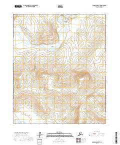
2017 Map of Bendeleben A-6 NE
USGS Topo · Published 2017About this map
The Kuzitrin River meanders across this northern section of the Seward Peninsula, a landscape defined by its remote river drainages and isolated geographic landmarks. In this part of the Nome Census Area, the presence of Idaho Bar and Brockways Bar along the riverbanks suggests a history of alluvial activity and potential prospecting sites common to this region's mining heritage. Rising above the river plains, Bunker Hill serves as a prominent navigational marker for travelers navigating the limited overland routes.
Find a feature on this map
17 named features on this map. Tap any name to fly to it.
Don’t see what you’re looking for? This feature index may not catch every label — zoom into the map to look around manually.
Map Details
Editions of this 2017 Bendeleben A-6 NE Map
This is the sole edition of this map. No revisions or reprints were ever made.
Other maps of this area

1950 · Bendeleben A-6
USGS Topo · 1:63,360

1950 · Bendeleben B-5
USGS Topo · 1:63,360

1950 · Bendeleben B-6
USGS Topo · 1:63,360

1950 · Bendeleben A-5
USGS Topo · 1:63,360

1950 · Bendeleben
USGS Topo · 1:250,000

1951 · Bendeleben
USGS Topo · 1:250,000

1964 · Bendeleben
USGS Topo · 1:250,000
2017 · Bendeleben A-6 NW
USGS Topo · 1:25,000
2017 · Bendeleben A-6 SW
USGS Topo · 1:25,000
2017 · Bendeleben B-5 SW
USGS Topo · 1:25,000