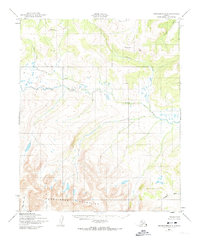
1950 Map of Bendeleben B-2
USGS Topo · Published 1974About this map
The Continental Divide cuts across the northern reaches of this Seward Peninsula landscape, separating the drainage systems of the interior. The central portion of the map is dominated by the winding course of the Koyuk River, which flows through a region marked by numerous small lakes and the Rapids upstream from its many tributary junctions. To the south, the terrain rises into the Bendeleben Mountains, where the headwaters of the Tubutulik River and Wagon Wheel Creek emerge from the steep slopes.
Find a feature on this map
13 named features on this map. Tap any name to fly to it.
Don’t see what you’re looking for? This feature index may not catch every label — zoom into the map to look around manually.
Map Details
Editions of this 1950 Bendeleben B-2 Map
3 editions found
Other maps of this area

1950 · Bendeleben C-1
USGS Topo · 1:63,360

1950 · Bendeleben C-3
USGS Topo · 1:63,360

1950 · Bendeleben B-2
USGS Topo · 1:63,360

1950 · Bendeleben A-3
USGS Topo · 1:63,360

1950 · Bendeleben C-2
USGS Topo · 1:63,360

1950 · Bendeleben B-1
USGS Topo · 1:63,360

1950 · Bendeleben A-2
USGS Topo · 1:63,360

1950 · Bendeleben A-1
USGS Topo · 1:63,360

1950 · Bendeleben B-3
USGS Topo · 1:63,360

1950 · Bendeleben
USGS Topo · 1:250,000