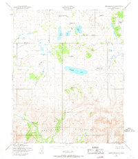
1950 Map of Bendeleben B-3
USGS Topo · Published 1967About this map
The Bendeleben Mountains dominate the southern half of this mid-century survey, rising sharply from the surrounding river basins and volcanic plateaus. The landscape is defined by its drainage patterns, with the Continental Divide winding through a cluster of volcanic features including Lost Jim Cone and Gosling Cone. To the south, Boston Creek and the Fish River flow through the foothills of the range, while the northern terrain is marked by the expansive Kuzitrin Lake and the meandering Kuzitrin River.
Find a feature on this map
20 named features on this map. Tap any name to fly to it.
Don’t see what you’re looking for? This feature index may not catch every label — zoom into the map to look around manually.
Map Details
Editions of this 1950 Bendeleben B-3 Map
3 editions found
Other maps of this area

1950 · Bendeleben A-4
USGS Topo · 1:63,360

1950 · Bendeleben C-3
USGS Topo · 1:63,360

1950 · Bendeleben B-2
USGS Topo · 1:63,360

1950 · Bendeleben A-3
USGS Topo · 1:63,360

1950 · Bendeleben C-2
USGS Topo · 1:63,360

1950 · Bendeleben B-4
USGS Topo · 1:63,360

1950 · Bendeleben C-4
USGS Topo · 1:63,360

1950 · Bendeleben A-2
USGS Topo · 1:63,360

1950 · Bendeleben B-3
USGS Topo · 1:63,360

1950 · Bendeleben
USGS Topo · 1:250,000