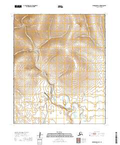
2019 Map of Bendeleben B-6 NE
USGS Topo · Published 2019About this map
The Kougarok River flows through this interior landscape of the Seward Peninsula, providing a central drainage for numerous tributaries like Niagara Cr and Checkers Cr. This 2019 survey captures the area north of the Nome gold fields, where the remote Quartz Creek /Kougarok/ Airport serves as a vital transportation link in a region largely defined by its hydrography rather than roads. The terrain is marked by distinct valleys such as Mauze Gulch and Ryan Gulch, which feed into the river system. To the east, Minguk Lake sits in a relatively level basin, contrasting with the drainages of Delome Cr and Angeles Cr that cut through the surrounding uplands. The absence of traditional settlements highlights the wilderness character of this part of the Nome Census Area, where the map focus remains on navigation via water and air.
Find a feature on this map
21 named features on this map. Tap any name to fly to it.
Don’t see what you’re looking for? This feature index may not catch every label — zoom into the map to look around manually.
Map Details
Editions of this 2019 Bendeleben B-6 NE Map
This is the sole edition of this map. No revisions or reprints were ever made.
Other maps of this area

1950 · Bendeleben C-5
USGS Topo · 1:63,360

1950 · Bendeleben B-5
USGS Topo · 1:63,360

1950 · Bendeleben B-6
USGS Topo · 1:63,360

1950 · Bendeleben C-6
USGS Topo · 1:63,360

1950 · Bendeleben
USGS Topo · 1:250,000

1951 · Bendeleben
USGS Topo · 1:250,000

1964 · Bendeleben
USGS Topo · 1:250,000
2014 · Bendeleben C-5 SW
USGS Topo · 1:25,000
2014 · Bendeleben B-6 NE
USGS Topo · 1:25,000
2014 · Bendeleben C-6 SW
USGS Topo · 1:25,000