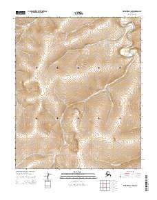
2014 Map of Bendeleben C-6 SW
USGS Topo · Published 2014About this map
The Kougarok River system dominates this Alaskan landscape north of Nome, revealing a complex drainage network shaped by the region's mining heritage. At this scale, the intricate relationship between the main river and its tributaries is clear, with the Left Fork Kougarok River and Coarse Gold Cr carving through the terrain. The presence of named drainages like Nugget Cr and California Cr suggests the historical prospecting and resource extraction that has long characterized the Bendeleben region.
Find a feature on this map
16 named features on this map. Tap any name to fly to it.
Don’t see what you’re looking for? This feature index may not catch every label — zoom into the map to look around manually.
Map Details
Editions of this 2014 Bendeleben C-6 SW Map
This is the sole edition of this map. No revisions or reprints were ever made.
Other maps of this area

1950 · Bendeleben B-6
USGS Topo · 1:63,360

1950 · Bendeleben C-6
USGS Topo · 1:63,360

1950 · Teller
USGS Topo · 1:250,000

1950 · Bendeleben
USGS Topo · 1:250,000

1950 · Teller B-1
USGS Topo · 1:63,360
1950 · Teller C-1
USGS Topo · 1:63,360

1951 · Bendeleben
USGS Topo · 1:250,000

1951 · Teller
USGS Topo · 1:250,000

1957 · Teller
USGS Topo · 1:250,000

1958 · Teller
USGS Topo · 1:250,000