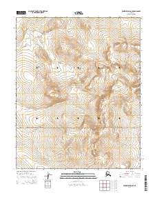
2014 Map of Bendeleben D-6 SE
USGS Topo · Published 2014About this map
Serpentine Hot Springs serves as a remote focal point within the high-latitude terrain of the Bering Land Bridge National Preserve. This 2014 survey documents a landscape defined by sharp elevation changes and the hydrological drainage of the Seward Peninsula. The Continental Divide winds through the eastern portion of the quadrangle, separating the headwaters of numerous creeks. Drainage patterns are clearly marked by the flow of Hot Springs Cr and Reindeer Cr to the west, while Midnight Cr flows from the slopes of Midnight Mountain in the southeast. This map captures the intersection of geothermal activity and subarctic tundra, providing a detailed record of the topography and named watercourses such as Schlitz Cr and Macklin Cr that define this protected Alaskan wilderness.
Find a feature on this map
15 named features on this map. Tap any name to fly to it.
Don’t see what you’re looking for? This feature index may not catch every label — zoom into the map to look around manually.
Map Details
Editions of this 2014 Bendeleben D-6 SE Map
This is the sole edition of this map. No revisions or reprints were ever made.
Other maps of this area

1950 · Bendeleben C-5
USGS Topo · 1:63,360

1950 · Bendeleben C-6
USGS Topo · 1:63,360

1950 · Bendeleben D-6
USGS Topo · 1:63,360

1950 · Bendeleben D-5
USGS Topo · 1:63,360

1950 · Bendeleben
USGS Topo · 1:250,000

1951 · Bendeleben
USGS Topo · 1:250,000

1964 · Bendeleben
USGS Topo · 1:250,000
2014 · Bendeleben D-6 SW
USGS Topo · 1:25,000
2014 · Bendeleben D-5 NW
USGS Topo · 1:25,000
2014 · Bendeleben C-6 NW
USGS Topo · 1:25,000