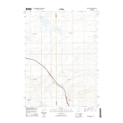
2015 Map of Bengough Hill
USGS Topo · Published 2015About this map
Bengough Hill stands as a prominent landmark in this high-altitude Wyoming landscape, situated along the county line where the Carbon and Albany borders meet. The map reveals an intricate network of water management features, including the Symes and Deerlove Ditch and several Northrop ditches, which draw from local sources like Cooper Creek. Large impoundments such as Bosler Reservoir and McFadden Reservoir Number 3 define the northern terrain, while the foothills of the Medicine Bow Mountains begin to rise in the southwest corner. The transition from prairie to mountain is marked by drainage patterns from Dutton Creek and the presence of Beaver Ponds, illustrating the complex hydrology essential for ranching and water rights in this arid region.
Find a feature on this map
26 named features on this map. Tap any name to fly to it.
Don’t see what you’re looking for? This feature index may not catch every label — zoom into the map to look around manually.
Map Details
Editions of this 2015 Bengough Hill Map
This is the sole edition of this map. No revisions or reprints were ever made.
Other maps of this area

1895 · Laramie
USGS Topo · 1:125,000

1902 · Laramie
USGS Topo · 1:125,000

1905 · Laramie
USGS Topo · 1:125,000

1906 · Medicine Bow
USGS Topo · 1:125,000

1906 · Laramie
USGS Topo · 1:125,000

1908 · Laramie
USGS Topo · 1:125,000

1908 · Medicine Bow
USGS Topo · 1:125,000

1954 · Cheyenne
USGS Topo · 1:250,000

1954 · Rawlins
USGS Topo · 1:250,000

1955 · Big Judson
USGS Topo · 1:24,000