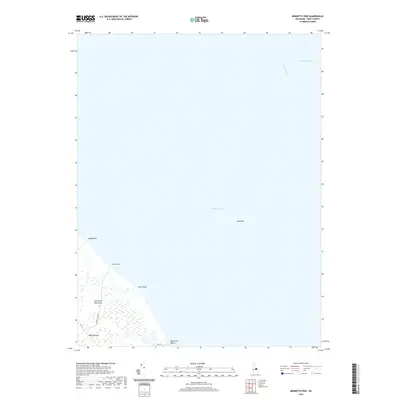
2019 Map of Bennetts Pier
USGS Topo · Published 2019About this map
Delmarva Peninsula's eastern edge meets the massive expanse of the Delaware Bay in this recent survey of Kent County's coastal lowlands. This region of Milford Neck is defined by its transition from tidal wetlands to the open waters of the bay, where the Delaware River flows southward into the Blake Channel. The map documents small coastal settlements like Bennetts Pier and Big Stone Beach, which represent some of the few landward points of access to this marshy shoreline. Inland, the landscape is primarily dominated by drainage patterns and local routes like Bennetts Pier Rd, which terminates at the waterfront. Features such as Sandy Point, Clark Point, and the offshore Hawknest provide essential reference points for understanding the shifting morphology of this Delaware shoreline and its maritime interfaces.
Find a feature on this map
13 named features on this map. Tap any name to fly to it.
Don’t see what you’re looking for? This feature index may not catch every label — zoom into the map to look around manually.
Map Details
Editions of this 2019 Bennetts Pier Map
This is the sole edition of this map. No revisions or reprints were ever made.
Other maps of this area

1890 · Maurice Cove
USGS Topo · 1:62,500

1891 · Maurice Cove
USGS Topo · 1:62,500

1899 · Vineland
USGS Topo · 1:125,000

1918 · Cedar Creek
USGS Topo · 1:62,500

1918 · Cape Henlopen
USGS Topo · 1:62,500

1919 · Cedar Creek
USGS Topo · 1:62,500

1919 · Vineland
USGS Topo · 1:125,000

1934 · Bowers
USGS Topo · 1:48,000
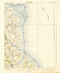
1936 · Bowers
USGS Topo · 1:62,500

1937 · Cape Henlopen
USGS Topo · 1:62,500