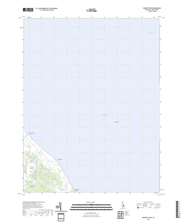
2023 Map of Bennetts Pier
USGS Topo · Published 2023About this map
The coastal wetlands of the Delmarva Peninsula meet the expansive waters of the Delaware Bay in this recent survey of Kent County. The landscape is defined by the shifting interface of tidal inlets and low-lying points, including Sandy Point and Clark Point. Inland, the preserved marshes of Milford Neck dominate the southern portion of the sheet, where narrow routes like Bennetts Pier Rd terminate at the shoreline. The settlement of Big Stone Beach stands as a rare point of residential development along an otherwise preserved coast. To the east, the bathymetry of the bay reveals the deep passage of Blake Channel and the navigation hazard of Hawknest. This map provides a clear record of the area's modern hydrography, showing the winding path of Brockonbridge Gut as it drains into the bay.
Find a feature on this map
12 named features on this map. Tap any name to fly to it.
Don’t see what you’re looking for? This feature index may not catch every label — zoom into the map to look around manually.
Map Details
Editions of this 2023 Bennetts Pier Map
This is the sole edition of this map. No revisions or reprints were ever made.
Other maps of this area

1890 · Maurice Cove
USGS Topo · 1:62,500

1891 · Maurice Cove
USGS Topo · 1:62,500

1899 · Vineland
USGS Topo · 1:125,000

1918 · Cedar Creek
USGS Topo · 1:62,500

1918 · Cape Henlopen
USGS Topo · 1:62,500

1919 · Cedar Creek
USGS Topo · 1:62,500

1919 · Vineland
USGS Topo · 1:125,000

1934 · Bowers
USGS Topo · 1:48,000
1936 · Bowers
USGS Topo · 1:62,500

1937 · Cape Henlopen
USGS Topo · 1:62,500