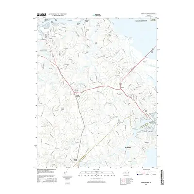
2016 Map of Benns Church
USGS Topo · Published 2016About this map
Smithfield and the surrounding Tidewater landscape define this coastal reach of the Pagan River and James River. The map details a complex network of waterways, from the Ballard Marsh and Ragged Island to the interior reaches of Jones Creek and Chuckatuck Creek. Established crossroads like Benns Church, Barlett, and Wills Corner sit amidst a shifting environment of swamps and creeks, including Champion Swamp and Green Swamp Creek.
Find a feature on this map
202 named features on this map. Tap any name to fly to it.
Don’t see what you’re looking for? This feature index may not catch every label — zoom into the map to look around manually.
Map Details
Editions of this 2016 Benns Church Map
This is the sole edition of this map. No revisions or reprints were ever made.
Other maps of this area

1907 · Norfolk
USGS Topo · 1:125,000

1907 · Yorktown
USGS Topo · 1:62,500

1907 · Hampton
USGS Topo · 1:62,500

1919 · Smithfield
USGS Topo · 1:62,500

1921 · Newport News
USGS Topo · 1:62,500

1943 · Yorktown
USGS Topo · 1:62,500

1943 · Richmond
USGS Topo · 1:250,000

1944 · Windsor
USGS Topo · 1:31,680

1944 · Morrison
USGS Topo · 1:24,000

1944 · Smithfield
USGS Topo · 1:24,000