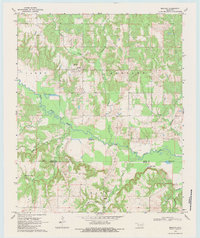
1969 Map of Bentley
USGS Topo · Published 1983About this map
Bentley and Matoy serve as the primary nodes of settlement in this landscape defined by the winding course of Clear Boggy Creek. The map documents a rural Oklahoma interface where the Atoka and Bryan County line bisects a network of family-named landmarks and water sources. Genealogists and local historians can find significant markers including Turnbull Cem near the Turnbull Springs and Matoy Cem situated to the south.
Find a feature on this map
24 named features on this map. Tap any name to fly to it.
Don’t see what you’re looking for? This feature index may not catch every label — zoom into the map to look around manually.
Map Details
Editions of this 1969 Bentley Map
2 editions found
Other maps of this area

1899 · Atoka
USGS Topo · 1:125,000

1900 · Atoka
USGS Topo · 1:125,000

1901 · Antlers
USGS Topo · 1:125,000

1912 · Antlers
USGS Topo · 1:125,000

1925 · Antlers
USGS Topo · 1:125,000

1950 · Mcalester
USGS Topo · 1:250,000

1957 · Bruno
USGS Topo · 1:24,000

1957 · Lane
USGS Topo · 1:24,000

1957 · Ardmore
USGS Topo · 1:250,000

1962 · McAlester
USGS Topo · 1:250,000